



For the record

Share
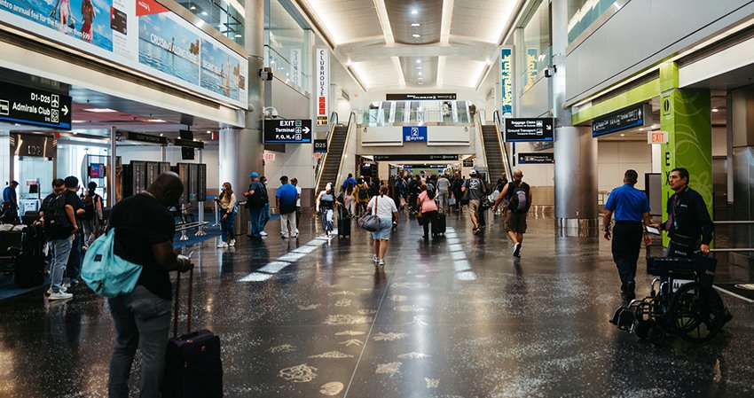
Cintoo’s Simon Shaw argues that data capture will be key for airports as they race to expand and modernise to meet demand and stay competitive.
In many cases, the age and complexity of airport infrastructure make the planning and execution of construction, maintenance and refurbishment projects both time-consuming and challenging.
With multiple stakeholders involved at different project phases, from airport owners and operators to architects and contractors, collaboration is essential from conceptual and detailed design stages right through to construction and ongoing maintenance.
A lack of integration between horizontal and vertical digital systems means any exchange of information is highly inefficient, which also makes standardising building and asset data nigh on impossible because of this lack of interoperability.
The pressure to operate efficiently is constant, but making the right decisions relies on having accurate information in order to optimise performance while minimising costs.
RECORDING THE PRESENT REAPS REWARDS IN THE FUTURE
It is, however, a common misconception to think that reality capture is purely suited to construction projects. In fact, reality capture provides high-precision 3D data for effective asset management and decision-making.
Laser scanning devices are ideal for capturing the as-built condition of airport infrastructure and facilities, both indoor and outdoor.
3D scans and BIM models of new sites and infrastructure help asset and facility managers generate a reliable source of information on which to base decisions during an asset’s lifecycle.
Far from being a peripheral technology limited to specialists during the construction phase, 3D spatial data offers immense value to both airport owner-operators and general contractors as a long-term asset.
Airport facilities are managing information both above ground and below the surface. As more organisations become data-centric, having reliable and reusable information at one’s fingertips is necessary to make quick and confident decisions.
Furthermore, the integration of reality capture with BIM modelling, GIS and IoT systems supports the development of digital twins and an airport’s overall common data environment.
By integrating reality capture data into digital twins, asset management and maintenance workflows are greatly enhanced.
WHY AIRPORTS SHOULD BE LEVERAGING LASER SCANNING
Airports consist of complex and diverse geospatial environments where laser scanning technology can be used for precise planning and measurement.
Public areas such as passenger check-in, baggage handling, security, retail environments and passenger lounges are typically large and long terminal buildings. In these locations, mobile mapping systems are ideal for fast capture while terrestrial scanners provide surveyor-grade inspection and measurement data.
These busy, crowded environments with constant foot traffic can make projects complicated to plan and execute.
However, once an area is scanned, review and inspection work can be performed remotely by the airport operator, the general contractor and others involved in a project with the right data management tools.
As a result, airport and contractor teams can perform remote inspection and reduce the costs required to perform physical inspection, maintenance and surveys, potentially avoiding the need to shutdown airport infrastructure.
BIM modelling processes are then faster, more accurate and less prone to error when based off a scan-to-BIM process that uses the scan data as the basis for the model.
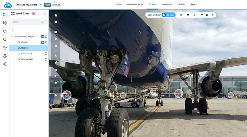
When it comes to technical environments and infrastructure, like air traffic control towers, runways, aprons, taxiways and bridges, terrestrial scanners perform high precision inspection and quality workflows on machinery and equipment as part of maintenance reviews, quality checks and planning replacements.
Several airlines, such as KLM and Lufthansa, use a combination of drones and laser scanners to perform aircraft maintenance reviews and to replace equipment.
By capturing high-precision 3D data and managing it through a reality capture data platform, teams can conduct remote inspections instead of on-site reviews, reducing operational disruptions, errors, and rework, while improving planning efficiency and worker safety.
Regularly scanning runways, aprons and taxiways, and comparing the current condition with previous scans, can identify deterioration over time and help with proactively planning fixes and upgrades.
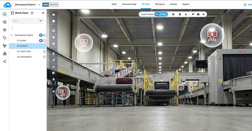
This scan data can then feed into a bigger asset management programme, consisting of 3D models, 2D plans, IoT, GIS systems and digital twins.
Digital twins, for example, are transforming maintenance strategies at airports where sensors have been embedded in critical infrastructure to enable AI to monitor elements like temperature and energy consumption to detect failure patterns.
By monitoring assets over time, digital twins will predict maintenance needs, identifying when equipment needs to be inspected or replaced before problems occur and unexpected downtime is needed.
Data platforms that bring fragmented information together can put an end to data silos and provide one accurate source of truth. This can then be shared with multiple stakeholders, from air traffic control to ground operations providing enhanced situational awareness.
Going forwards, airports are likely run on platform-based solutions that power AI-driven tools for everything from spotting anomalies to personalising passenger experiences.
SCANNING FOR THE FUTURE
Airports are among the most complex infrastructure environments in the world. Using reality capture technology airports can instantly improve visibility to facilitate better decision-making not just for specific projects but on an ongoing basis.
Reality capture data can feed digital twins, mirroring physical environments so that assets can be monitored throughout their lifecycle.
Advanced 3D scanning is replacing traditional surveying methods, cutting data collection time by up to 80% in large, active environments like Vienna and JFK airports, where teams can now map thousands of square metres daily without disrupting operations.
At Melbourne Airport, Arup used a reality capture data platform to perform remote inspections and plan work in advance, minimising on-site exposure and reducing costly downtime.
While Aéroports de Montréal leveraged the same cloud-based platform to compare scans with BIM models for precision QA/QC, all while ensuring strict compliance with SOC 2 Type 2 and ISO 27001 data protection standards.
Across these airports, faster data capture, safer workflows, and enhanced collaboration are redefining how infrastructure is maintained and expanded.
Teams can map thousands of square metres daily and then upload this data where it can immediately be accessed by stakeholders.
Stakeholders can make informed decisions without visiting sites physically, reducing the need to travel and making projects more transparent and collaborative.
Unified platforms further break down information barriers between stakeholders.
Merged with artificial intelligence, this data enables anomaly detection and predictive maintenance, turning reactive processes into proactive management strategies.
Reality capture technology is bridging the gap between physical infrastructure and digital management systems all in aid of more efficient operations and reduced costs.
In adopting these solutions, airports can better tackle macro and micro challenges and adapt with greater agility.