



London Heathrow has gone live with a new geospatial mapping system designed to modernise workflows for 3,000 staff.
Part of the airport’s Asset Management and Compliance Programme, mobile applications have been designed to help support operations, winter resilience, the fire service and make Heathrow’s ‘digital engineer’ strategy possible.
Called Heathrow Explorer, the new mapping and data platform is a core component of Heathrow’s digital transformation strategy, and will provide a real-time, single view of infrastructure and assets, enabling teams to make faster and better decisions.
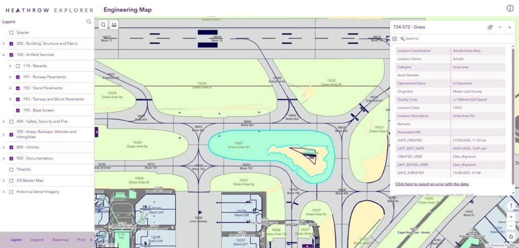
Using interactive maps and dashboards, the system brings together previously siloed technical and operational information on more than 500,000 assets.
The initial launch includes applications for up to 3,000 staff across Engineering, Operations, Fire Service, Property, Retail and airport third parties, including airlines.
Created by Esri UK using its GIS (Geographic Information System), the new approach replaces outdated legacy software with increased functionality, enhanced security and mobile access.
Containing almost 300 different layers of information, the mapping system makes Heathrow’s ‘digital engineer’ strategy possible. Engineers can now quickly access data relating to the airport’s asset base from any location, making maintenance planning, inspections and site visits safer and more efficient.

The airport’s Asset Management and Compliance Programme is focused on renewing and maintaining Heathrow’s critical infrastructure, including runways, terminals, security and baggage to improve operational performance and the passenger experience.
Gavin Payne, Heaathrow’s director of engineering and baggagt, said: “Location intelligence is becoming a core capability in how we achieve Heathrow’s asset management and operational goals.
“Our new Esri platform is making it easier for colleagues to access and use the information they need, improving everyday efficiency, supporting better decision-making and helping build a more resilient airport.”
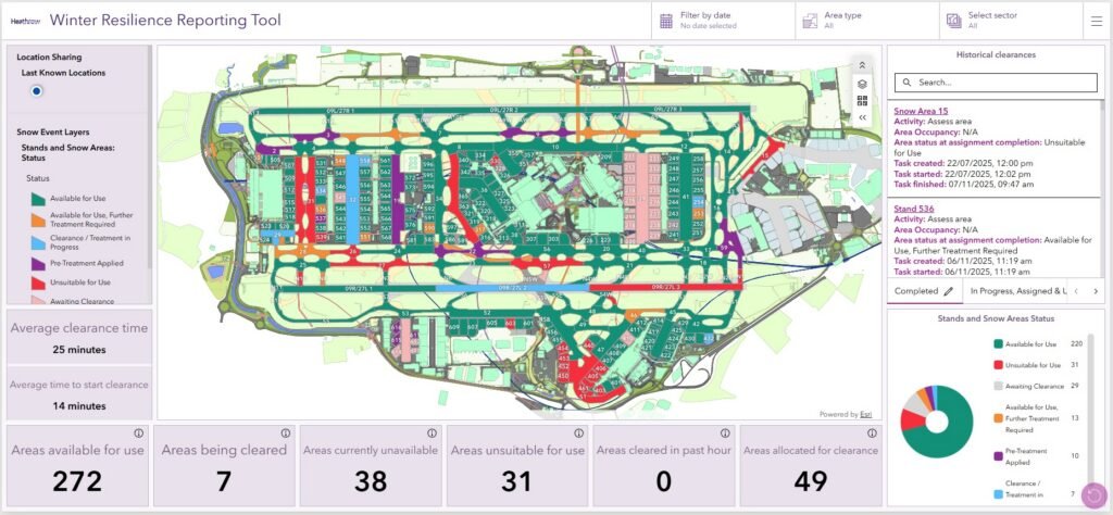
The first application to go live was Winter Resilience, providing airfield teams with real-time updates on airside snow clearance or de-icing activity.
Replacing manual workflows which used printed maps, the new tool gives teams a single operational picture on handheld devices. Airfield managers can dispatch the nearest available clearance team and track progress instantly, helping speed up snow clearance activities to avoid flight delays during winter.
Improving access to information via mobile devices is a key driver of the new system. One example is a new application designed for the fire services team, showing all water assets with live hydrant and water network availability, including Heathrow’s 72 miles of fire mains.
Fire crews can now access maps and graphical information about assets from mobile devices, which helps improve incident response and future scenario planning.

The geospatial system has been extended to major contractors working on Heathrow’s asset management and compliance programme, enhancing collaboration and helping to streamline construction projects. A new tool to manage the airport’s noise and vortex compensation and repairs scheme for neighbouring properties has also gone live.
Future developments include applications for the Heathrow Expansion Programme and the use of Esri Indoor GIS to improve terminal navigation for passengers and staff on smartphones.
Pete Wilkinson, Esri’s managing director for the UK, commented: “Heathrow is demonstrating what next generation airport geospatial systems look like.
“By unifying spatial data to streamline workflows, the airport is creating a digital foundation that will fuel innovation for years to come and keep delivering a world class passenger experience.”